
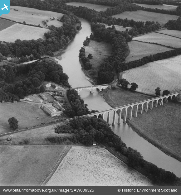
SAW039325 SCOTLAND (1951). Leaderfoot Viaduct and Road Bridge, Leaderfoot. An oblique aerial photograph taken facing south-east. This image has been produced from a print.
© Copyright OpenStreetMap contributors and licensed by the OpenStreetMap Foundation. 2025. Cartography is licensed as CC BY-SA.
Nearby Images (3)
SAW039325

SAW039326

SAW039327

Details
| Title | [SAW039325] Leaderfoot Viaduct and Road Bridge, Leaderfoot. An oblique aerial photograph taken facing south-east. This image has been produced from a print. |
| Reference | SAW039325 |
| Date | 1951 |
| Link | NRHE Collection item 1315277 |
| Place name | |
| Parish | MELROSE |
| District | ETTRICK AND LAUDERDALE |
| Country | SCOTLAND |
| Easting / Northing | 357530, 634668 |
| Longitude / Latitude | -2.6741508530133, 55.603769293198 |
| National Grid Reference | NT575347 |
Pins
Be the first to add a comment to this image!