
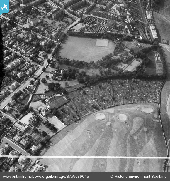
SAW039045 SCOTLAND (1951). Edinburgh, general view, showing St Leonard's Hall, Holyrood Park Road and Salisbury Green, Dalkeith Road. An oblique aerial photograph taken facing north-west. This image has been produced from a crop marked negative.
© Copyright OpenStreetMap contributors and licensed by the OpenStreetMap Foundation. 2026. Cartography is licensed as CC BY-SA.
Nearby Images (7)
SAW039045

SAW039050

SAW039044

SAW039046

SAW039047

SAW039048

SAW039049

Details
| Title | [SAW039045] Edinburgh, general view, showing St Leonard's Hall, Holyrood Park Road and Salisbury Green, Dalkeith Road. An oblique aerial photograph taken facing north-west. This image has been produced from a crop marked negative. |
| Reference | SAW039045 |
| Date | 1951 |
| Link | NRHE Collection item 1297638 |
| Place name | |
| Parish | EDINBURGH (EDINBURGH, CITY OF) |
| District | CITY OF EDINBURGH |
| Country | SCOTLAND |
| Easting / Northing | 326980, 672340 |
| Longitude / Latitude | -3.1690870342585, 55.938599526196 |
| National Grid Reference | NT270723 |
