
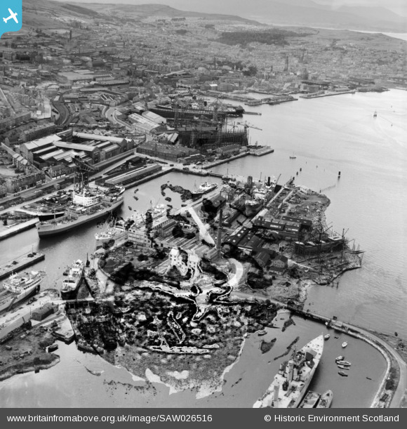
SAW026516 SCOTLAND (1949). James Watt Dock and Cartsdyke Shipyards, Greenock Harbour. An oblique aerial photograph taken facing west. This image has been produced from a damaged negative.
© Copyright OpenStreetMap contributors and licensed by the OpenStreetMap Foundation. 2026. Cartography is licensed as CC BY-SA.
Nearby Images (13)
SAW026516

SAW026512

SAW026510

SAW026513

SAW026511

SAW026507

SAW026509

SAW006116

SAW006117

SAW006118

SAW006119

SAW006120

SAW006121

Details
| Title | [SAW026516] James Watt Dock and Cartsdyke Shipyards, Greenock Harbour. An oblique aerial photograph taken facing west. This image has been produced from a damaged negative. |
| Reference | SAW026516 |
| Date | 1949 |
| Link | NRHE Collection item 1269363 |
| Place name | |
| Parish | GREENOCK |
| District | INVERCLYDE |
| Country | SCOTLAND |
| Easting / Northing | 229531, 675854 |
| Longitude / Latitude | -4.730092679599, 55.945476438375 |
| National Grid Reference | NS295759 |
Pins

Andy A |
Sunday 8th of April 2018 01:33:45 AM |