
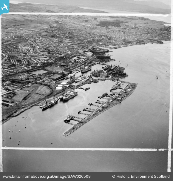
SAW026509 SCOTLAND (1949). Greenock Harbour. An oblique aerial photograph taken facing west. This image has been produced from a crop marked negative.
© Copyright OpenStreetMap contributors and licensed by the OpenStreetMap Foundation. 2026. Cartography is licensed as CC BY-SA.
Nearby Images (6)
SAW026507

SAW026509

SAW026510

SAW026513

SAW026516

SAW026512

Details
| Title | [SAW026509] Greenock Harbour. An oblique aerial photograph taken facing west. This image has been produced from a crop marked negative. |
| Reference | SAW026509 |
| Date | 1949 |
| Link | NRHE Collection item 1269358 |
| Place name | |
| Parish | GREENOCK |
| District | INVERCLYDE |
| Country | SCOTLAND |
| Easting / Northing | 229677, 675697 |
| Longitude / Latitude | -4.7276583223647, 55.944119012961 |
| National Grid Reference | NS297757 |
Pins

yes |
Friday 10th of January 2025 12:46:15 AM | |
|
The Local Historian |
Thursday 2nd of May 2019 07:45:15 PM | |
|
Andy A |
Sunday 8th of April 2018 01:44:17 AM | |
|
Andy A |
Sunday 8th of April 2018 01:43:48 AM | |
|
ken |
Saturday 1st of August 2015 03:09:03 PM | |
This looks more like the visually similar "Merchant Aircraft Carrier", which was simply a flight deck bolted onto the hull of an existing merchantman (tanker or grain carrier), and which retained its merchant cargo capabilities. These ships had minimal servicing and self-defense capabilities (beyond their air contingent) and carried a small naval personnel contingent but remained merchantmen and were named as such. They were released to be reinstanted as merchantmen in 1944/1945, which appears to be in progress in this photo. A chunk has been cut out of the flight deck and there is clearly visible a funnel poking through the flight deck. |
Andy A |
Sunday 8th of April 2018 01:42:12 AM |