
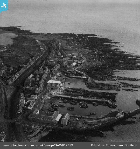
SAW019479 SCOTLAND (1948). Gourdon, general view, showing Gourdon Harbour and W Peter and Co. Ltd. Selbie Works. An oblique aerial photograph taken facing east. This image has been produced from a print.
© Copyright OpenStreetMap contributors and licensed by the OpenStreetMap Foundation. 2026. Cartography is licensed as CC BY-SA.
Nearby Images (8)
SAW019479

SAW019480

SAW019468

SAW019470

SAW019473

SAW019475

SAW019477

SAW019478

Details
| Title | [SAW019479] Gourdon, general view, showing Gourdon Harbour and W Peter and Co. Ltd. Selbie Works. An oblique aerial photograph taken facing east. This image has been produced from a print. |
| Reference | SAW019479 |
| Date | 1948 |
| Link | NRHE Collection item 1314904 |
| Place name | |
| Parish | BERVIE |
| District | KINCARDINE AND DEESIDE |
| Country | SCOTLAND |
| Easting / Northing | 382712, 770758 |
| Longitude / Latitude | -2.2833094118061, 56.828128025739 |
| National Grid Reference | NO827708 |
Pins
Be the first to add a comment to this image!