
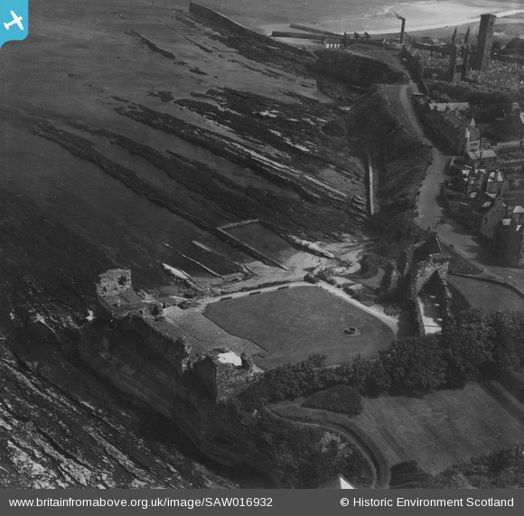
SAW016932 SCOTLAND (1948). St Andrews Castle and Hind Rock. An oblique aerial photograph taken facing south-east. This image has been produced from a print.
© Copyright OpenStreetMap contributors and licensed by the OpenStreetMap Foundation. 2026. Cartography is licensed as CC BY-SA.
Nearby Images (11)
SAW016929

SAW016932

SPW040384

SPW020136

SAW016930

SAW016931

SAW024475

SPW040389

SAW005305

SPW040385

SAW024474

Details
| Title | [SAW016932] St Andrews Castle and Hind Rock. An oblique aerial photograph taken facing south-east. This image has been produced from a print. |
| Reference | SAW016932 |
| Date | 1948 |
| Link | NRHE Collection item 1314771 |
| Place name | |
| Parish | ST ANDREWS AND ST LEONARDS |
| District | NORTH EAST FIFE |
| Country | SCOTLAND |
| Easting / Northing | 351310, 716870 |
| Longitude / Latitude | -2.7877421519272, 56.341768122742 |
| National Grid Reference | NO513169 |
Pins
Be the first to add a comment to this image!