
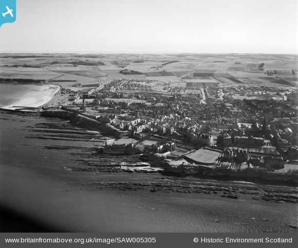
SAW005305 SCOTLAND (1947). St. Andrews, general view, showing Castlecliffe House, The Scores and St Andrews Cathedral. An oblique aerial photograph taken facing south.
© Copyright OpenStreetMap contributors and licensed by the OpenStreetMap Foundation. 2026. Cartography is licensed as CC BY-SA.
Nearby Images (12)
SAW005305

SAW009811

SPW040384

SPW040385

SPW020134

SAW009814

SAW005306

SAW024474

SAW016929

SAW016932

SAW009809

SPW020137

Details
| Title | [SAW005305] St. Andrews, general view, showing Castlecliffe House, The Scores and St Andrews Cathedral. An oblique aerial photograph taken facing south. |
| Reference | SAW005305 |
| Date | 1947 |
| Link | NRHE Collection item 1268530 |
| Place name | |
| Parish | ST ANDREWS AND ST LEONARDS |
| District | NORTH EAST FIFE |
| Country | SCOTLAND |
| Easting / Northing | 351258, 716672 |
| Longitude / Latitude | -2.7885466612405, 56.339983862127 |
| National Grid Reference | NO513167 |
Pins
Be the first to add a comment to this image!