
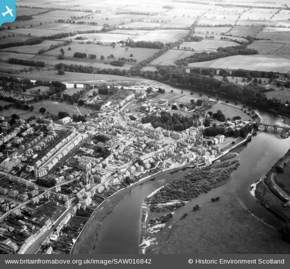
SAW016842 SCOTLAND (1948). Kelso, general view, showing Roxburgh Street and Wood Market. An oblique aerial photograph taken facing east.
© Copyright OpenStreetMap contributors and licensed by the OpenStreetMap Foundation. 2026. Cartography is licensed as CC BY-SA.
Nearby Images (10)
SAW016842

SAW016840

SAR035975

SAW016843

SPW042178

SPW042182

SPW042179

SAW016841

SPW042181

SPW042180

Details
| Title | [SAW016842] Kelso, general view, showing Roxburgh Street and Wood Market. An oblique aerial photograph taken facing east. |
| Reference | SAW016842 |
| Date | 1948 |
| Link | NRHE Collection item 1269054 |
| Place name | |
| Parish | KELSO |
| District | ROXBURGH |
| Country | SCOTLAND |
| Easting / Northing | 372811, 633981 |
| Longitude / Latitude | -2.4315288206362, 55.598689229704 |
| National Grid Reference | NT728340 |
Pins
Be the first to add a comment to this image!