
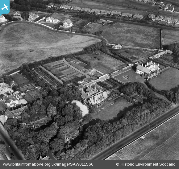
SAW011566 SCOTLAND (1947). Piersland, Craigend Road, Troon. An oblique aerial photograph taken facing north.
© Copyright OpenStreetMap contributors and licensed by the OpenStreetMap Foundation. 2026. Cartography is licensed as CC BY-SA.
Nearby Images (6)
SAW011566

SAW011567

SAW011564

SAW011568

SAW011563

SAW011565

Details
| Title | [SAW011566] Piersland, Craigend Road, Troon. An oblique aerial photograph taken facing north. |
| Reference | SAW011566 |
| Date | 1947 |
| Link | NRHE Collection item 1268784 |
| Place name | |
| Parish | DUNDONALD (KYLE AND CARRICK) |
| District | KYLE AND CARRICK |
| Country | SCOTLAND |
| Easting / Northing | 233054, 629882 |
| Longitude / Latitude | -4.6456560088955, 55.534047869376 |
| National Grid Reference | NS331299 |
Pins
Be the first to add a comment to this image!