
SAW003590 SCOTLAND (1947). Loch Garry. An oblique aerial photograph.

© Copyright OpenStreetMap contributors and licensed by the OpenStreetMap Foundation. 2025. Cartography is licensed as CC BY-SA.
Nearby Images (3)
SAR021135

SAW003589

SAW003590

Details
| Title | [SAW003590] Loch Garry. An oblique aerial photograph. |
| Reference | SAW003590 |
| Date | 1947 |
| Link | Canmore Collection item 1268506 |
| Place name | |
| Parish | KILMONIVAIG |
| District | LOCHABER |
| Country | SCOTLAND |
| Easting / Northing | 227600, 802028 |
| Longitude / Latitude | -4.8445973750874, 57.077105191285 |
| National Grid Reference | NH276020 |
Pins
Be the first to add a comment to this image!
User Comment Contributions
Dear slowcoach and David Wilson, Thanks for this identification. A quick check of the Ordnance Survey and Google Earth suggests that in the foreground is the River Garry flowing out of the Loch. The revised record will appear here in due course. Brian Wilkinson Britain from Above Activity Officer (Scotland). |
 Brian Wilkinson |
Thursday 30th of August 2012 12:17:44 PM |
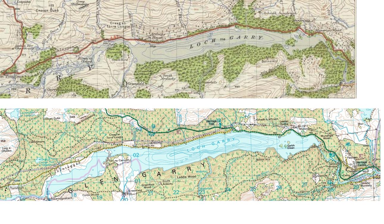 I agree this looks like Loch Garry. The 1947 OS map shows that the water level did used to be lower. The peninsula at the east end became islands in 2012 OS map, after dams raised the water level. |
slowcoach |
Friday 20th of July 2012 12:38:53 PM |
I am fairly sure that this is Loch Garry, taken from somewhere in the vicinity of Invergarry (NH310010) looking west. The water level must be fairly low for the islands in the near end of the loch to appear as large as they do here. |
David Wilson |
Thursday 19th of July 2012 09:10:47 PM |