
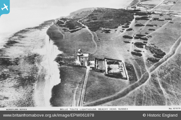
EPW061878 ENGLAND (1939). The Belle Tout Lighthouse, Beachy Head, 1939. This image has been produced from a copy-negative.
© Copyright OpenStreetMap contributors and licensed by the OpenStreetMap Foundation. 2026. Cartography is licensed as CC BY-SA.
Nearby Images (10)
EPW061878

EPW061872

EPW061876

EPW061877

EPW061875

EPW061879

EPW061874

EPW061873

EPW061880

EPW061881

Details
| Title | [EPW061878] The Belle Tout Lighthouse, Beachy Head, 1939. This image has been produced from a copy-negative. |
| Reference | EPW061878 |
| Date | 12-June-1939 |
| Link | |
| Place name | BEACHY HEAD |
| Parish | |
| District | |
| Country | ENGLAND |
| Easting / Northing | 556321, 95529 |
| Longitude / Latitude | 0.21561596841759, 50.737734629822 |
| National Grid Reference | TV563955 |
Pins
Be the first to add a comment to this image!
User Comment Contributions

Belle Tout Lighthouse |

Alan McFaden |
Wednesday 12th of November 2014 05:37:27 PM |