
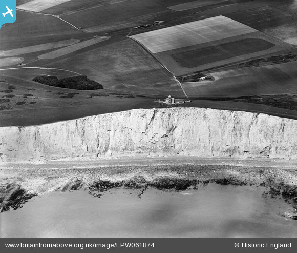
EPW061874 ENGLAND (1939). The Belle Tout Lighthouse, Beachy Head, 1939
© Copyright OpenStreetMap contributors and licensed by the OpenStreetMap Foundation. 2026. Cartography is licensed as CC BY-SA.
Nearby Images (10)
EPW061874

EPW061879

EPW061875

EPW061873

EPW061876

EPW061872

EPW061878

EPW061877

EPW061880

EPW061881

Details
| Title | [EPW061874] The Belle Tout Lighthouse, Beachy Head, 1939 |
| Reference | EPW061874 |
| Date | 12-June-1939 |
| Link | |
| Place name | BEACHY HEAD |
| Parish | |
| District | |
| Country | ENGLAND |
| Easting / Northing | 556314, 95485 |
| Longitude / Latitude | 0.21549816781686, 50.737341088347 |
| National Grid Reference | TV563955 |
Pins

Alan McFaden |
Sunday 20th of October 2013 10:27:40 PM |
