
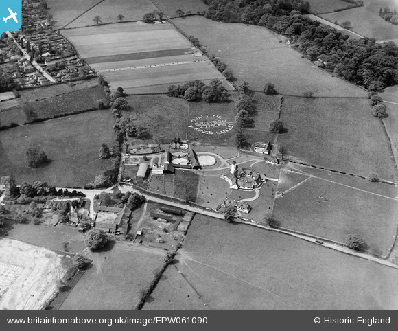
EPW061090 ENGLAND (1939). The Ovaltine Dairy Farm and environs, Abbots Langley, 1939
© Copyright OpenStreetMap contributors and licensed by the OpenStreetMap Foundation. 2026. Cartography is licensed as CC BY-SA.
Nearby Images (23)
EPW061090

EPW052809
, Abbots Langley, 1937")
EPW052815
, Abbots Langley, 1937")
EPW052816
, Abbots Langley, 1937")
EPW052817
, Abbots Langley, 1937")
EPW040444

EPW052810
, Abbots Langley, 1937")
EPW052813
, Abbots Langley, 1937")
EPW040443

EPW040445

EPW040447

EPW052811
, Abbots Langley, 1937")
EPW052814
, Abbots Langley, 1937")
EPW052812
, Abbots Langley, 1937")
EPW040446

EPW040454

EPW040441

EPW040442

EPW040452

EPW040448

EPW040449

EPW040450

EPW040451

Details
| Title | [EPW061090] The Ovaltine Dairy Farm and environs, Abbots Langley, 1939 |
| Reference | EPW061090 |
| Date | 20-May-1939 |
| Link | |
| Place name | ABBOTS LANGLEY |
| Parish | ABBOTS LANGLEY |
| District | |
| Country | ENGLAND |
| Easting / Northing | 509522, 202612 |
| Longitude / Latitude | -0.41463051031309, 51.711077786591 |
| National Grid Reference | TL095026 |
Pins

brian |
Saturday 28th of February 2015 01:03:11 AM |