
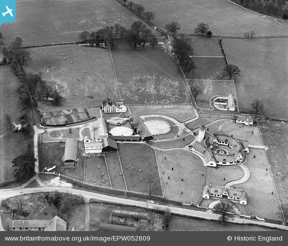
EPW052809 ENGLAND (1937). The Ovaltine Dairy Farm (Parsonage Farm), Abbots Langley, 1937
© Copyright OpenStreetMap contributors and licensed by the OpenStreetMap Foundation. 2026. Cartography is licensed as CC BY-SA.
Nearby Images (23)
EPW052809
, Abbots Langley, 1937")
EPW061090

EPW052815
, Abbots Langley, 1937")
EPW052816
, Abbots Langley, 1937")
EPW052817
, Abbots Langley, 1937")
EPW040444

EPW052810
, Abbots Langley, 1937")
EPW052813
, Abbots Langley, 1937")
EPW040445

EPW040447

EPW052811
, Abbots Langley, 1937")
EPW040443

EPW052812
, Abbots Langley, 1937")
EPW052814
, Abbots Langley, 1937")
EPW040454

EPW040446

EPW040441

EPW040442

EPW040452

EPW040448

EPW040449

EPW040450

EPW040451

Details
| Title | [EPW052809] The Ovaltine Dairy Farm (Parsonage Farm), Abbots Langley, 1937 |
| Reference | EPW052809 |
| Date | 16-April-1937 |
| Link | |
| Place name | ABBOTS LANGLEY |
| Parish | ABBOTS LANGLEY |
| District | |
| Country | ENGLAND |
| Easting / Northing | 509520, 202619 |
| Longitude / Latitude | -0.41465724882014, 51.711141098286 |
| National Grid Reference | TL095026 |
Pins

Farm Buildings |
Wednesday 25th of September 2013 02:05:56 PM |
User Comment Contributions

farm buildings |
Farm Buildings |
Wednesday 25th of September 2013 02:06:09 PM |