
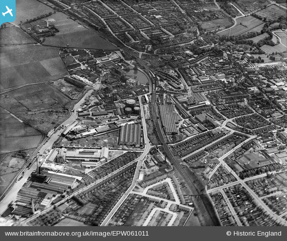
EPW061011 ENGLAND (1939). The town, Dartford, 1939
© Copyright OpenStreetMap contributors and licensed by the OpenStreetMap Foundation. 2026. Cartography is licensed as CC BY-SA.
Nearby Images (20)
EPW061011

EPW021979

EPW021982

EPW061013

EPW010894

EPW010895

EPW021980

EPW061015

EPW061012

EPW021977

EPW061007

EPW061006

EPW061008

EPW057057

EPW010893

EPW021976

EAW001394

EPW061014

EPR000367

EPW061010

Details
| Title | [EPW061011] The town, Dartford, 1939 |
| Reference | EPW061011 |
| Date | 22-May-1939 |
| Link | |
| Place name | DARTFORD |
| Parish | |
| District | |
| Country | ENGLAND |
| Easting / Northing | 554093, 174551 |
| Longitude / Latitude | 0.21778852705944, 51.448460758895 |
| National Grid Reference | TQ541746 |
Pins

BJM |
Thursday 17th of February 2022 04:06:47 PM | |
|
alastair wallace |
Saturday 21st of November 2015 12:47:22 AM |