
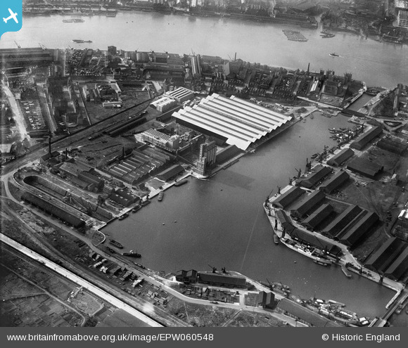
EPW060548 ENGLAND (1939). Millwall Outer Dock, Millwall, 1939
© Copyright OpenStreetMap contributors and licensed by the OpenStreetMap Foundation. 2026. Cartography is licensed as CC BY-SA.
Nearby Images (19)
EPW060548

EAW011757

EAW011753

EPW046147

EPW046146

EAW011755

EAW011752

EPW046148

EAW011759

EPW046145

EAW011756

EAW011758

EPW044131

EAW011754

EPW044130

EPW046149

EPW060455

EAW009803

EAW021114

Details
| Title | [EPW060548] Millwall Outer Dock, Millwall, 1939 |
| Reference | EPW060548 |
| Date | 28-February-1939 |
| Link | |
| Place name | MILLWALL |
| Parish | |
| District | |
| Country | ENGLAND |
| Easting / Northing | 537600, 178979 |
| Longitude / Latitude | -0.017701275889465, 51.49250468641 |
| National Grid Reference | TQ376790 |
Pins

moses72 |
Friday 20th of December 2013 02:26:09 PM |