
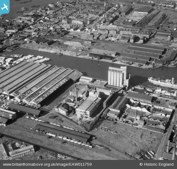
EAW011759 ENGLAND (1947). McDougalls Limited Wheatsheaf Flour Mills, Millwall, 1947
© Copyright OpenStreetMap contributors and licensed by the OpenStreetMap Foundation. 2026. Cartography is licensed as CC BY-SA.
Nearby Images (18)
EAW011759

EPW046146

EPW046147

EPW046145

EPW044130

EAW011754

EAW011755

EAW011757

EPW060548

EPW060455

EPW046149

EPW044131

EAW011753

EAW011752

EAW011756

EAW011758

EPW046148

EAW009803

Details
| Title | [EAW011759] McDougalls Limited Wheatsheaf Flour Mills, Millwall, 1947 |
| Reference | EAW011759 |
| Date | 9-October-1947 |
| Link | |
| Place name | MILLWALL |
| Parish | |
| District | |
| Country | ENGLAND |
| Easting / Northing | 537497, 178992 |
| Longitude / Latitude | -0.019179099270549, 51.492646581212 |
| National Grid Reference | TQ375790 |
Pins

PeterJames |
Tuesday 23rd of October 2012 05:53:46 PM | |
|
PeterJames |
Tuesday 23rd of October 2012 05:51:50 PM |