
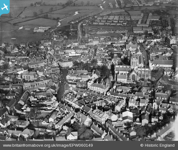
EPW060149 ENGLAND (1938). St Mary's Church and the town centre, Nantwich, 1938
© Copyright OpenStreetMap contributors and licensed by the OpenStreetMap Foundation. 2026. Cartography is licensed as CC BY-SA.
Nearby Images (6)
EPW060149

EPW060148

EPW038474

EPW038471

EPW038475

EPW038472

Details
| Title | [EPW060149] St Mary's Church and the town centre, Nantwich, 1938 |
| Reference | EPW060149 |
| Date | 17-November-1938 |
| Link | |
| Place name | NANTWICH |
| Parish | NANTWICH |
| District | |
| Country | ENGLAND |
| Easting / Northing | 365143, 352339 |
| Longitude / Latitude | -2.5202540625763, 53.066852326235 |
| National Grid Reference | SJ651523 |
Pins

PJN |
Tuesday 13th of January 2026 04:32:37 PM | |
|
PJN |
Tuesday 13th of January 2026 04:30:16 PM | |
|
PJN |
Tuesday 13th of January 2026 04:27:49 PM | |
|
totoro |
Sunday 23rd of June 2013 12:02:05 PM | |
|
totoro |
Sunday 23rd of June 2013 12:00:54 PM | |
|
totoro |
Sunday 23rd of June 2013 11:58:57 AM | |
|
totoro |
Sunday 23rd of June 2013 11:58:19 AM | |
|
totoro |
Sunday 23rd of June 2013 11:57:18 AM | |
|
totoro |
Sunday 23rd of June 2013 11:56:57 AM |