
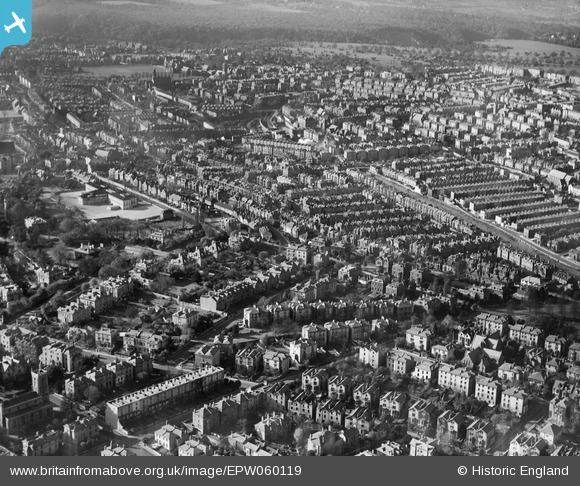
EPW060119 ENGLAND (1938). The residential area at Cotham, Bristol, 1938
© Copyright OpenStreetMap contributors and licensed by the OpenStreetMap Foundation. 2026. Cartography is licensed as CC BY-SA.
Nearby Images (3)
EPW060119

EPW048316

EPW048317

Details
| Title | [EPW060119] The residential area at Cotham, Bristol, 1938 |
| Reference | EPW060119 |
| Date | 1-November-1938 |
| Link | |
| Place name | BRISTOL |
| Parish | |
| District | |
| Country | ENGLAND |
| Easting / Northing | 358359, 174212 |
| Longitude / Latitude | -2.5995033560668, 51.464857856228 |
| National Grid Reference | ST584742 |
Pins

Doc Bob |
Wednesday 23rd of August 2017 05:04:55 PM | |
|
Doc Bob |
Wednesday 23rd of August 2017 05:03:46 PM | |
|
Doc Bob |
Wednesday 23rd of August 2017 05:02:35 PM | |
|
ChurchCrawler |
Saturday 5th of July 2014 06:34:33 PM | |

Class31 |
Thursday 12th of December 2013 09:16:38 PM | |
|
Isleworth1961 |
Wednesday 12th of June 2013 09:27:25 AM |