
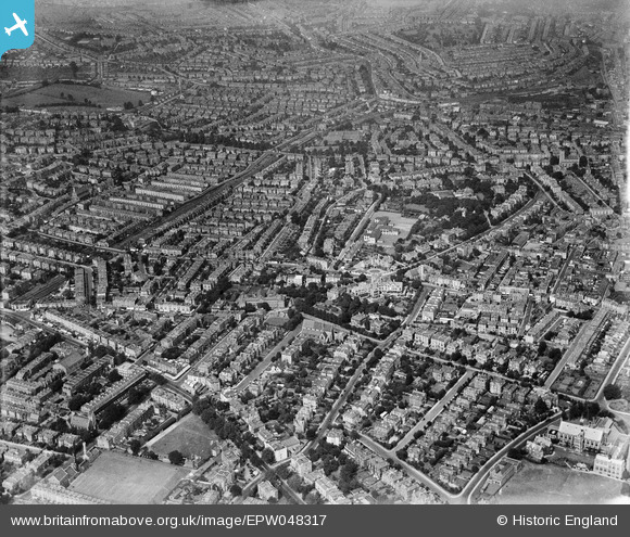
EPW048317 ENGLAND (1935). The residential area at Cotham, Cotham, 1935
© Copyright OpenStreetMap contributors and licensed by the OpenStreetMap Foundation. 2026. Cartography is licensed as CC BY-SA.
Nearby Images (5)
EPW048317

EPW048318

EPW060116

EPW048316

EPW060119

Details
| Title | [EPW048317] The residential area at Cotham, Cotham, 1935 |
| Reference | EPW048317 |
| Date | July-1935 |
| Link | |
| Place name | COTHAM |
| Parish | |
| District | |
| Country | ENGLAND |
| Easting / Northing | 358159, 174006 |
| Longitude / Latitude | -2.6023581865886, 51.462990735518 |
| National Grid Reference | ST582740 |
Pins

Igrade |
Thursday 20th of February 2014 09:02:17 PM | |
|
Isleworth1961 |
Wednesday 12th of June 2013 09:29:02 AM |