
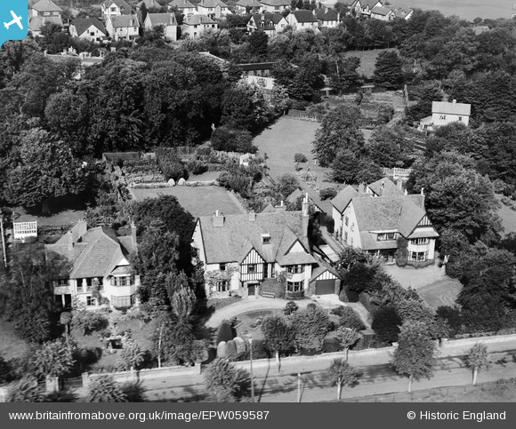
EPW059587 ENGLAND (1938). Greenlawn house along Rectory Road, Burnham-on-Sea, 1938
© Copyright OpenStreetMap contributors and licensed by the OpenStreetMap Foundation. 2026. Cartography is licensed as CC BY-SA.
Nearby Images (9)
EPW059587

EPW059586

EPW059589

EPW059585

EPW059584

EPW059590

EPW059592

EPW059593

EPW059591

Details
| Title | [EPW059587] Greenlawn house along Rectory Road, Burnham-on-Sea, 1938 |
| Reference | EPW059587 |
| Date | 24-September-1938 |
| Link | |
| Place name | BURNHAM-ON-SEA |
| Parish | BURNHAM-ON-SEA AND HIGHBRIDGE |
| District | |
| Country | ENGLAND |
| Easting / Northing | 330760, 150076 |
| Longitude / Latitude | -2.9920942971903, 51.245137730237 |
| National Grid Reference | ST308501 |


