
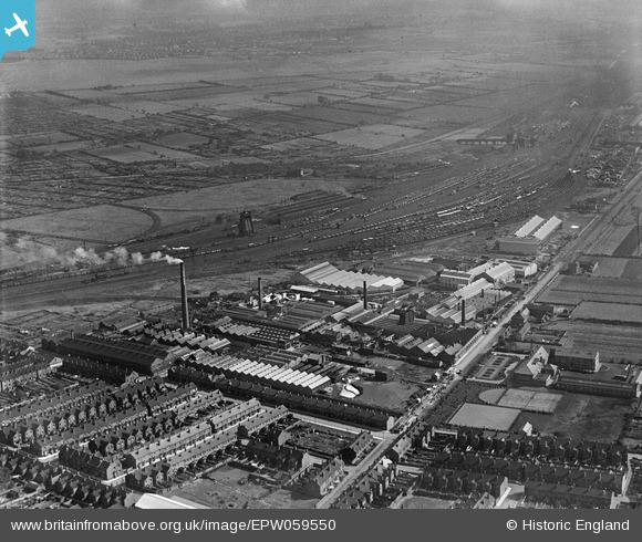
EPW059550 ENGLAND (1938). The British Rope Works on Carr Hill, the Mineral Sidings and environs, Doncaster, 1938
© Copyright OpenStreetMap contributors and licensed by the OpenStreetMap Foundation. 2026. Cartography is licensed as CC BY-SA.
Nearby Images (15)
EPW059550

EPW059549

EPW059548

EPW059546

EPW059544

EPW059545

EPW059547

EPW049318
 and environs, Doncaster, 1935")
EPW049314
 and environs, Doncaster, 1935")
EPW049316
 and environs, Doncaster, from the south-east, 1935")
EPW049312
 and environs, Doncaster, 1935")
EPW049311
 and environs, Doncaster, 1935")
EPW049313
 and environs, Doncaster, 1935")
EPW049315
 and environs, Doncaster, 1935")
EPW049317
 and environs, Doncaster, from the south, 1935")
Details
| Title | [EPW059550] The British Rope Works on Carr Hill, the Mineral Sidings and environs, Doncaster, 1938 |
| Reference | EPW059550 |
| Date | 22-September-1938 |
| Link | |
| Place name | DONCASTER |
| Parish | |
| District | |
| Country | ENGLAND |
| Easting / Northing | 457386, 401708 |
| Longitude / Latitude | -1.1346040423405, 53.508673812868 |
| National Grid Reference | SE574017 |
Pins
Be the first to add a comment to this image!