
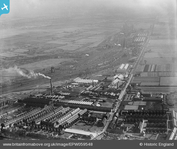
EPW059548 ENGLAND (1938). The British Rope Works on Carr Hill, the Mineral Sidings and environs, Doncaster, 1938
© Copyright OpenStreetMap contributors and licensed by the OpenStreetMap Foundation. 2026. Cartography is licensed as CC BY-SA.
Nearby Images (15)
EPW059548

EPW059550

EPW059549

EPW059547

EPW059544

EPW059546

EPW059545

EPW049316
 and environs, Doncaster, from the south-east, 1935")
EPW049318
 and environs, Doncaster, 1935")
EPW049314
 and environs, Doncaster, 1935")
EPW049312
 and environs, Doncaster, 1935")
EPW049313
 and environs, Doncaster, 1935")
EPW049311
 and environs, Doncaster, 1935")
EPW049315
 and environs, Doncaster, 1935")
EPW049317
 and environs, Doncaster, from the south, 1935")
Details
| Title | [EPW059548] The British Rope Works on Carr Hill, the Mineral Sidings and environs, Doncaster, 1938 |
| Reference | EPW059548 |
| Date | 22-September-1938 |
| Link | |
| Place name | DONCASTER |
| Parish | |
| District | |
| Country | ENGLAND |
| Easting / Northing | 457400, 401630 |
| Longitude / Latitude | -1.134407230719, 53.507971187593 |
| National Grid Reference | SE574016 |
Pins
Be the first to add a comment to this image!