
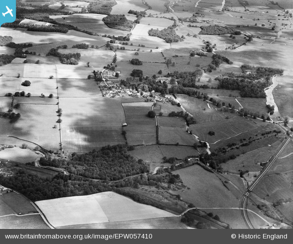
EPW057410 ENGLAND (1938). Mottisfont Abbey, the village and surrounding countryside, Mottisfont, 1938
© Copyright OpenStreetMap contributors and licensed by the OpenStreetMap Foundation. 2026. Cartography is licensed as CC BY-SA.
Nearby Images (2)
EPW057410

EPW057411

Details
| Title | [EPW057410] Mottisfont Abbey, the village and surrounding countryside, Mottisfont, 1938 |
| Reference | EPW057410 |
| Date | 3-June-1938 |
| Link | |
| Place name | MOTTISFONT |
| Parish | MOTTISFONT |
| District | |
| Country | ENGLAND |
| Easting / Northing | 432562, 126465 |
| Longitude / Latitude | -1.5355469749703, 51.036083945003 |
| National Grid Reference | SU326265 |
Pins

Lee |
Wednesday 23rd of October 2013 05:39:46 AM | |
|
Lee |
Wednesday 23rd of October 2013 05:39:03 AM | |
|
Lee |
Wednesday 23rd of October 2013 05:38:05 AM | |
|
Lee |
Wednesday 23rd of October 2013 05:36:32 AM | |
|
Lee |
Wednesday 23rd of October 2013 05:36:27 AM | |

totoro |
Monday 12th of August 2013 09:58:10 PM | |
|
totoro |
Monday 12th of August 2013 09:56:46 PM |