
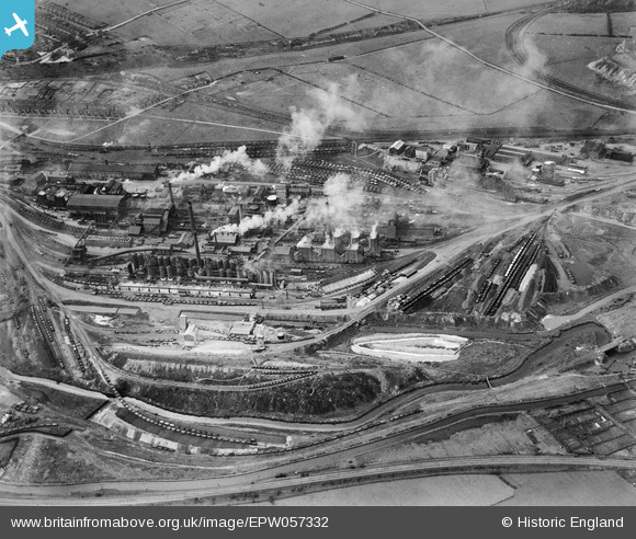
EPW057332 ENGLAND (1938). The Staveley Coal and Iron Company Ltd Works, Staveley, 1938
© Copyright OpenStreetMap contributors and licensed by the OpenStreetMap Foundation. 2026. Cartography is licensed as CC BY-SA.
Nearby Images (23)
EPW057332

EPW057344

EPW041680

EPW057353

EAW003064

EAW009691

EPW041676

EAW044350

EAW003062

EPW041681

EPW041678

EAW003069

EPW057336

EPW041679

EAW003066

EAW003063

EAW003070

EPW041682

EPW041674

EPW041673

EPW057347

EAW009690

EAW003067

Details
| Title | [EPW057332] The Staveley Coal and Iron Company Ltd Works, Staveley, 1938 |
| Reference | EPW057332 |
| Date | 3-June-1938 |
| Link | |
| Place name | STAVELEY |
| Parish | STAVELEY |
| District | |
| Country | ENGLAND |
| Easting / Northing | 442498, 374838 |
| Longitude / Latitude | -1.3627186493313, 53.268551845608 |
| National Grid Reference | SK425748 |
Pins

MB |
Sunday 23rd of June 2013 11:08:30 PM |