
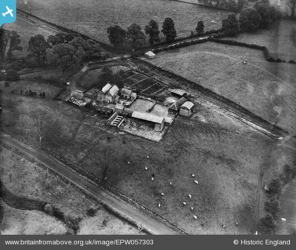
EPW057303 ENGLAND (1938). Hunts Mill Farm, Vastern, 1938
© Copyright OpenStreetMap contributors and licensed by the OpenStreetMap Foundation. 2026. Cartography is licensed as CC BY-SA.
Nearby Images (9)
EPW057303

EPW057302

EPW058985

EPW058988

EPW058984

EPW058986

EPW058987

EPW057304

EPW057305

Details
| Title | [EPW057303] Hunts Mill Farm, Vastern, 1938 |
| Reference | EPW057303 |
| Date | 1-June-1938 |
| Link | |
| Place name | VASTERN |
| Parish | WOOTTON BASSETT |
| District | |
| Country | ENGLAND |
| Easting / Northing | 405543, 181580 |
| Longitude / Latitude | -1.9200796041951, 51.532619872872 |
| National Grid Reference | SU055816 |
Pins

MB |
Monday 24th of June 2013 10:23:23 AM |