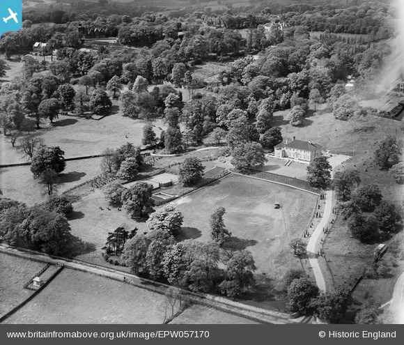
EPW057170 ENGLAND (1938). Brenaire Park House and Garden, Rawdon, 1938
    © Copyright OpenStreetMap contributors and licensed by the OpenStreetMap Foundation. 2025. Cartography is licensed as CC BY-SA.
  
Nearby Images (6)
Details
| Title | [EPW057170] Brenaire Park House and Garden, Rawdon, 1938 | 
| Reference | EPW057170 | 
| Date | 24-May-1938 | 
| Link | |
| Place name | RAWDON | 
| Parish | |
| District | |
| Country | ENGLAND | 
| Easting / Northing | 420302, 438743 | 
| Longitude / Latitude | -1.6913999778502, 53.844323915731 | 
| National Grid Reference | SE203387 | 
Pins
|   James Chandler | Monday 2nd of September 2019 03:38:03 PM | |
| Hi, where did this photo come from and are there any more? I am doing some research about this place. :-) |   Sannavally | Tuesday 4th of May 2021 02:37:46 PM | 
 
             
  ![[EPW057170] Brenaire Park House and Garden, Rawdon, 1938](http://britainfromabove.org.uk/sites/all/libraries/aerofilms-images/public/100x100/EPW/057/EPW057170.jpg) 
  
                                          ![[EPW057171] Brenaire Park House and Garden, Rawdon, 1938](http://britainfromabove.org.uk/sites/all/libraries/aerofilms-images/public/100x100/EPW/057/EPW057171.jpg) 
 ![[EPW057167] Brenaire Park House and Garden, Rawdon, 1938](http://britainfromabove.org.uk/sites/all/libraries/aerofilms-images/public/100x100/EPW/057/EPW057167.jpg) 
 ![[EPW057172] Brenaire Park House and Garden, Rawdon, 1938](http://britainfromabove.org.uk/sites/all/libraries/aerofilms-images/public/100x100/EPW/057/EPW057172.jpg) 
 ![[EPW057169] Brenaire Park House, Rawdon, 1938](http://britainfromabove.org.uk/sites/all/libraries/aerofilms-images/public/100x100/EPW/057/EPW057169.jpg) 
 ![[EPW057168] Brenaire Park House, Rawdon, 1938](http://britainfromabove.org.uk/sites/all/libraries/aerofilms-images/public/100x100/EPW/057/EPW057168.jpg) 
 
 The porch of Acacia, all that remains of this house.
 The porch of Acacia, all that remains of this house.