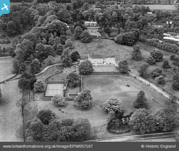
EPW057167 ENGLAND (1938). Brenaire Park House and Garden, Rawdon, 1938
    © Copyright OpenStreetMap contributors and licensed by the OpenStreetMap Foundation. 2025. Cartography is licensed as CC BY-SA.
  
Nearby Images (6)
Details
| Title | [EPW057167] Brenaire Park House and Garden, Rawdon, 1938 | 
| Reference | EPW057167 | 
| Date | 24-May-1938 | 
| Link | |
| Place name | RAWDON | 
| Parish | |
| District | |
| Country | ENGLAND | 
| Easting / Northing | 420332, 438750 | 
| Longitude / Latitude | -1.6909435075255, 53.844385663819 | 
| National Grid Reference | SE203388 | 
Pins
Be the first to add a comment to this image!
 
             
  ![[EPW057167] Brenaire Park House and Garden, Rawdon, 1938](http://britainfromabove.org.uk/sites/all/libraries/aerofilms-images/public/100x100/EPW/057/EPW057167.jpg) 
  
                                          ![[EPW057172] Brenaire Park House and Garden, Rawdon, 1938](http://britainfromabove.org.uk/sites/all/libraries/aerofilms-images/public/100x100/EPW/057/EPW057172.jpg) 
 ![[EPW057169] Brenaire Park House, Rawdon, 1938](http://britainfromabove.org.uk/sites/all/libraries/aerofilms-images/public/100x100/EPW/057/EPW057169.jpg) 
 ![[EPW057170] Brenaire Park House and Garden, Rawdon, 1938](http://britainfromabove.org.uk/sites/all/libraries/aerofilms-images/public/100x100/EPW/057/EPW057170.jpg) 
 ![[EPW057171] Brenaire Park House and Garden, Rawdon, 1938](http://britainfromabove.org.uk/sites/all/libraries/aerofilms-images/public/100x100/EPW/057/EPW057171.jpg) 
 ![[EPW057168] Brenaire Park House, Rawdon, 1938](http://britainfromabove.org.uk/sites/all/libraries/aerofilms-images/public/100x100/EPW/057/EPW057168.jpg)