
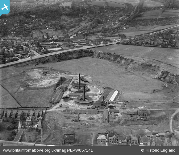
EPW057141 ENGLAND (1938). Thorneywood Brick Works, Carlton, 1938
© Copyright OpenStreetMap contributors and licensed by the OpenStreetMap Foundation. 2026. Cartography is licensed as CC BY-SA.
Nearby Images (5)
EPW057141

EPW057140

EPW057143

EPW057139

EPW057142

Details
| Title | [EPW057141] Thorneywood Brick Works, Carlton, 1938 |
| Reference | EPW057141 |
| Date | 20-May-1938 |
| Link | |
| Place name | CARLTON |
| Parish | |
| District | |
| Country | ENGLAND |
| Easting / Northing | 459365, 341463 |
| Longitude / Latitude | -1.115993044494, 52.96692542363 |
| National Grid Reference | SK594415 |
Pins

NorthChurch |
Thursday 24th of February 2022 04:08:37 PM | |
|
NorthChurch |
Thursday 24th of February 2022 04:04:47 PM | |
|
NorthChurch |
Thursday 24th of February 2022 04:04:15 PM | |
|
NorthChurch |
Thursday 24th of February 2022 04:02:59 PM | |
|
DavidA |
Sunday 23rd of July 2017 06:24:19 PM |