
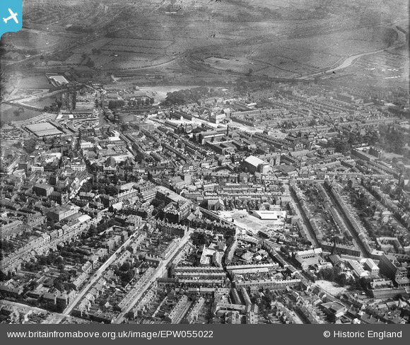
EPW055022 ENGLAND (1937). St Peter's Street and the city, Derby, from the south-west, 1937
© Copyright OpenStreetMap contributors and licensed by the OpenStreetMap Foundation. 2026. Cartography is licensed as CC BY-SA.
Nearby Images (5)
EPW055022

EPW005814

EAW004655

EPW055027

EAW004654

Details
| Title | [EPW055022] St Peter's Street and the city, Derby, from the south-west, 1937 |
| Reference | EPW055022 |
| Date | August-1937 |
| Link | |
| Place name | DERBY |
| Parish | |
| District | |
| Country | ENGLAND |
| Easting / Northing | 435063, 335777 |
| Longitude / Latitude | -1.4784682232933, 52.917948866633 |
| National Grid Reference | SK351358 |
Pins

60's Soul |
Sunday 25th of January 2026 04:19:44 PM | |
|
60's Soul |
Sunday 25th of January 2026 04:17:44 PM | |
|
60's Soul |
Sunday 25th of January 2026 04:15:26 PM | |
|
60's Soul |
Sunday 25th of January 2026 04:13:20 PM | |
|
60's Soul |
Sunday 25th of January 2026 04:12:38 PM | |
|
60's Soul |
Sunday 25th of January 2026 04:11:47 PM | |
|
60's Soul |
Sunday 25th of January 2026 04:10:34 PM | |
|
60's Soul |
Sunday 25th of January 2026 04:09:59 PM | |
|
60's Soul |
Sunday 25th of January 2026 04:09:14 PM | |
|
60's Soul |
Sunday 25th of January 2026 04:07:24 PM | |
|
HelsyB |
Thursday 7th of January 2021 08:06:27 PM | |
|
HelsyB |
Thursday 7th of January 2021 08:02:12 PM | |
|
HelsyB |
Thursday 7th of January 2021 08:01:45 PM | |
|
BGP |
Thursday 14th of August 2014 09:48:53 PM | |
|
BGP |
Thursday 14th of August 2014 09:47:22 PM |