
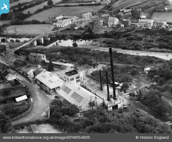
EPW054805 ENGLAND (1937). Torrington Creamery, Great Torrington, 1937
© Copyright OpenStreetMap contributors and licensed by the OpenStreetMap Foundation. 2026. Cartography is licensed as CC BY-SA.
Nearby Images (7)
EPW054805

EPW054809

EPW054807

EPW054804

EPW054808

EPW054806

EPW059617

Details
| Title | [EPW054805] Torrington Creamery, Great Torrington, 1937 |
| Reference | EPW054805 |
| Date | August-1937 |
| Link | |
| Place name | GREAT TORRINGTON |
| Parish | GREAT TORRINGTON |
| District | |
| Country | ENGLAND |
| Easting / Northing | 248707, 118777 |
| Longitude / Latitude | -4.1540089362569, 50.948000555128 |
| National Grid Reference | SS487188 |
Pins
Be the first to add a comment to this image!