
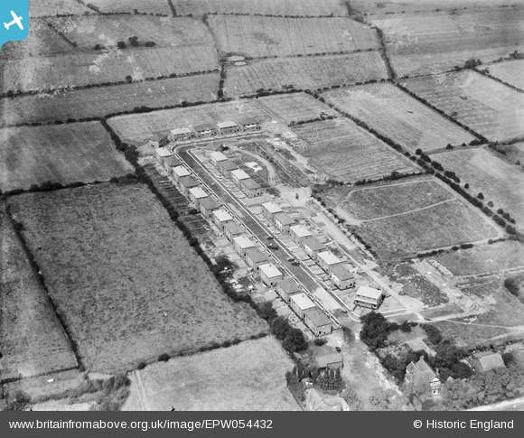
EPW054432 ENGLAND (1937). Laburnum Road, Lowton St Mary's, 1937
© Copyright OpenStreetMap contributors and licensed by the OpenStreetMap Foundation. 2026. Cartography is licensed as CC BY-SA.
Nearby Images (5)
EPW054432

EPW054435

EPW054431

EPW054434

EPW054433

Details
| Title | [EPW054432] Laburnum Road, Lowton St Mary's, 1937 |
| Reference | EPW054432 |
| Date | 30-July-1937 |
| Link | |
| Place name | LOWTON ST MARY'S |
| Parish | |
| District | |
| Country | ENGLAND |
| Easting / Northing | 362653, 397470 |
| Longitude / Latitude | -2.5627183898232, 53.472383750538 |
| National Grid Reference | SJ627975 |
Pins

Class31 |
Tuesday 18th of June 2013 10:52:41 AM | |
Magic! We'll update the catalogue and post the new record here in due course. Yours, Katy Britain from Above Cataloguing Team Leader |
Katy Whitaker |
Tuesday 2nd of July 2013 04:55:29 PM |
User Comment Contributions
I was able to locate these five photos mainly from looking at the photos on each side in the numbering sequence which were of Leigh and Prescot. This reduced down the area to search and I don't have a Liverpool Ordnance 1:50000 which I could have laid out. Then it was a question of looking for patterns of roads. Cedar, King's and Beech Avenues form a distinctive shape and I was lucky to find it without taking too much time. Eveything fits including a distinctive house in Laburnum Avenue which is placed at an angle to the road |
Class31 |
Tuesday 2nd of July 2013 05:00:31 PM |