
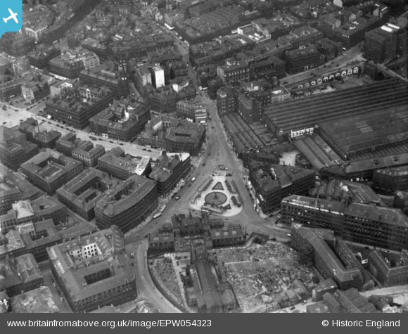
EPW054323 ENGLAND (1937). Forster Square and environs, Bradford, 1937. This image has been produced from a print.
© Copyright OpenStreetMap contributors and licensed by the OpenStreetMap Foundation. 2026. Cartography is licensed as CC BY-SA.
Nearby Images (21)
EPW054323

EPW024394

EPW054317

EPW054315

EPW057184

EPW045329

EAW047325

EAW049784

EPW052164

EPW045330

EPW054316

EAW047323

EPW054312

EAW049790

EAW049786

EAW049783

EAW049789

EAW049785

EAW049787

EAW049788

EPW024505

Details
| Title | [EPW054323] Forster Square and environs, Bradford, 1937. This image has been produced from a print. |
| Reference | EPW054323 |
| Date | 14-July-1937 |
| Link | |
| Place name | BRADFORD |
| Parish | |
| District | |
| Country | ENGLAND |
| Easting / Northing | 416533, 433245 |
| Longitude / Latitude | -1.7489854161471, 53.795036635576 |
| National Grid Reference | SE165332 |
Pins
Be the first to add a comment to this image!