
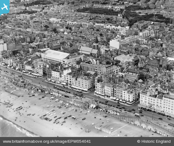
EPW054041 ENGLAND (1937). King's Road and the town, Brighton, from the south-east, 1937
© Copyright OpenStreetMap contributors and licensed by the OpenStreetMap Foundation. 2026. Cartography is licensed as CC BY-SA.
Nearby Images (6)
EPW054041

EPW016878

EPW000723

EPW039530

EPW054039

EAW022260

Details
| Title | [EPW054041] King's Road and the town, Brighton, from the south-east, 1937 |
| Reference | EPW054041 |
| Date | June-1937 |
| Link | |
| Place name | BRIGHTON |
| Parish | |
| District | |
| Country | ENGLAND |
| Easting / Northing | 530865, 103974 |
| Longitude / Latitude | -0.14195633345461, 50.819941629921 |
| National Grid Reference | TQ309040 |
Pins

Tom |
Friday 23rd of February 2018 05:04:27 PM | |

Alan McFaden |
Friday 15th of November 2013 05:24:47 PM | |
|
Alan McFaden |
Monday 9th of September 2013 12:15:20 PM | |
|
Alan McFaden |
Monday 9th of September 2013 12:13:39 PM |


