
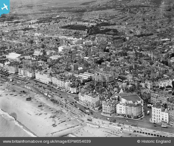
EPW054039 ENGLAND (1937). Grand Junction Road, the Town Hall and the town, Brighton, from the south-east, 1937
© Copyright OpenStreetMap contributors and licensed by the OpenStreetMap Foundation. 2026. Cartography is licensed as CC BY-SA.
Nearby Images (11)
EPW054039

EPW016878

EAW022260

EPW041372

EPW000515

EPW054041

EPW039534

EPW016879

EPW039530

EPW039537

EAW022253

Details
| Title | [EPW054039] Grand Junction Road, the Town Hall and the town, Brighton, from the south-east, 1937 |
| Reference | EPW054039 |
| Date | June-1937 |
| Link | |
| Place name | BRIGHTON |
| Parish | |
| District | |
| Country | ENGLAND |
| Easting / Northing | 531075, 103974 |
| Longitude / Latitude | -0.13897639578767, 50.819894123778 |
| National Grid Reference | TQ311040 |
Pins

designking |
Wednesday 17th of September 2014 08:18:04 PM | |

Class31 |
Tuesday 3rd of June 2014 12:04:14 PM | |

Alan McFaden |
Friday 15th of November 2013 05:28:11 PM | |
|
Alan McFaden |
Monday 9th of September 2013 12:21:22 PM | |
|
Alan McFaden |
Monday 9th of September 2013 12:20:43 PM | |
|
Alan McFaden |
Monday 9th of September 2013 12:19:23 PM |


