
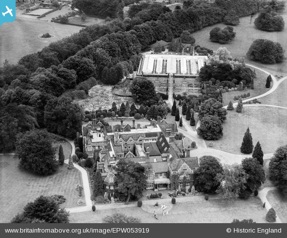
EPW053919 ENGLAND (1937). Dell Park and garden, Englefield Green, 1937
© Copyright OpenStreetMap contributors and licensed by the OpenStreetMap Foundation. 2025. Cartography is licensed as CC BY-SA.
Nearby Images (9)
EPW053919

EPW053920

EPW053914

EPW053907

EPW053918

EPW053911

EPW053909

EPW053908

EPW053915

Details
| Title | [EPW053919] Dell Park and garden, Englefield Green, 1937 |
| Reference | EPW053919 |
| Date | June-1937 |
| Link | |
| Place name | ENGLEFIELD GREEN |
| Parish | |
| District | |
| Country | ENGLAND |
| Easting / Northing | 498090, 171689 |
| Longitude / Latitude | -0.58869178918365, 51.43520686192 |
| National Grid Reference | SU981717 |
Pins

Ellensdottir |
Tuesday 7th of January 2014 11:00:59 PM |