
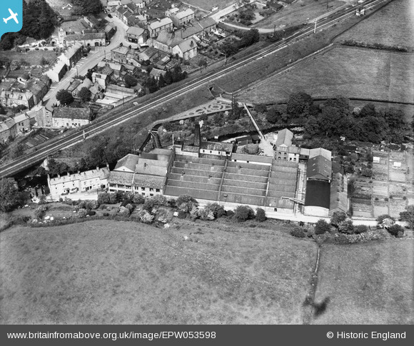
EPW053598 ENGLAND (1937). The Low Silk Mills, Low Bentham, 1937
© Copyright OpenStreetMap contributors and licensed by the OpenStreetMap Foundation. 2026. Cartography is licensed as CC BY-SA.
Nearby Images (7)
EPW053598

EPW053599

EPW053602

EPW053597

EPW053600

EPW053603

EPW053601

Details
| Title | [EPW053598] The Low Silk Mills, Low Bentham, 1937 |
| Reference | EPW053598 |
| Date | 11-June-1937 |
| Link | |
| Place name | LOW BENTHAM |
| Parish | BENTHAM |
| District | |
| Country | ENGLAND |
| Easting / Northing | 364923, 469286 |
| Longitude / Latitude | -2.5366958781424, 54.118067261434 |
| National Grid Reference | SD649693 |
Pins

Jane |
Friday 10th of April 2015 09:43:13 PM |