
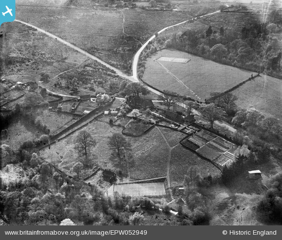
EPW052949 ENGLAND (1937). Chuck Hatch Road and environs, Chuck Hatch, from the north-east, 1937
© Copyright OpenStreetMap contributors and licensed by the OpenStreetMap Foundation. 2025. Cartography is licensed as CC BY-SA.
Nearby Images (4)
EPW052949

EPW052946

EPW052948

EPW052947

Details
| Title | [EPW052949] Chuck Hatch Road and environs, Chuck Hatch, from the north-east, 1937 |
| Reference | EPW052949 |
| Date | 4-May-1937 |
| Link | |
| Place name | CHUCK HATCH |
| Parish | HARTFIELD |
| District | |
| Country | ENGLAND |
| Easting / Northing | 547491, 133197 |
| Longitude / Latitude | 0.10578154418132, 51.078581379501 |
| National Grid Reference | TQ475332 |
Pins
Be the first to add a comment to this image!