
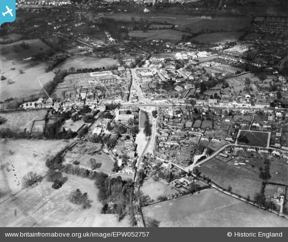
EPW052757 ENGLAND (1937). The town, Beaconsfield, 1937. This image has been produced from a copy-negative.
© Copyright OpenStreetMap contributors and licensed by the OpenStreetMap Foundation. 2026. Cartography is licensed as CC BY-SA.
Nearby Images (3)
EPW052757

EPW054667

EAW026484

Details
| Title | [EPW052757] The town, Beaconsfield, 1937. This image has been produced from a copy-negative. |
| Reference | EPW052757 |
| Date | 24-March-1937 |
| Link | |
| Place name | BEACONSFIELD |
| Parish | BEACONSFIELD |
| District | |
| Country | ENGLAND |
| Easting / Northing | 494516, 190046 |
| Longitude / Latitude | -0.63517373424413, 51.600842760647 |
| National Grid Reference | SU945900 |
Pins

moses72 |
Monday 11th of April 2016 05:31:11 PM | |
|
bondi |
Thursday 4th of December 2014 11:11:05 PM |