
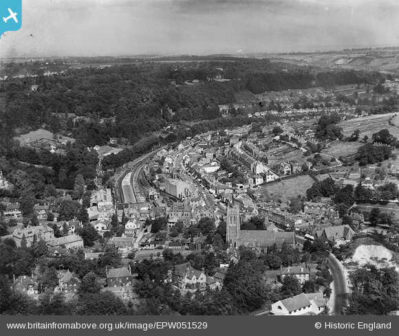
EPW051529 ENGLAND (1936). St John's Church, the railway station and environs, Caterham, from the south-east, 1936
© Copyright OpenStreetMap contributors and licensed by the OpenStreetMap Foundation. 2026. Cartography is licensed as CC BY-SA.
Nearby Images (5)
EPW051529

EAW022692

EAW047574

EAW047572

EAW047575

Details
| Title | [EPW051529] St John's Church, the railway station and environs, Caterham, from the south-east, 1936 |
| Reference | EPW051529 |
| Date | August-1936 |
| Link | |
| Place name | CATERHAM |
| Parish | CATERHAM VALLEY |
| District | |
| Country | ENGLAND |
| Easting / Northing | 534225, 155283 |
| Longitude / Latitude | -0.075250872935837, 51.280346476901 |
| National Grid Reference | TQ342553 |
Pins

williamayerst |
Wednesday 3rd of June 2020 08:41:58 AM | |
|
KiwiMike |
Sunday 17th of July 2016 11:47:08 AM | |
|
John Wass |
Tuesday 26th of April 2016 02:27:04 PM |