
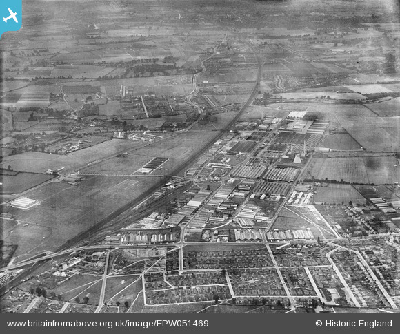
EPW051469 ENGLAND (1936). Slough Trading Estate and environs, Slough, from the north-east, 1936
© Copyright OpenStreetMap contributors and licensed by the OpenStreetMap Foundation. 2026. Cartography is licensed as CC BY-SA.
Nearby Images (7)
EPW051469

EPW025673

EPW025674

EPW025659

EPW025656

EPW051471

EPW000024

Details
| Title | [EPW051469] Slough Trading Estate and environs, Slough, from the north-east, 1936 |
| Reference | EPW051469 |
| Date | August-1936 |
| Link | |
| Place name | SLOUGH |
| Parish | |
| District | |
| Country | ENGLAND |
| Easting / Northing | 496298, 181160 |
| Longitude / Latitude | -0.61188409973022, 51.520657746191 |
| National Grid Reference | SU963812 |
Pins

payitforwardeddie |
Sunday 17th of May 2015 01:44:55 PM | |
|
dave43 |
Sunday 7th of July 2013 09:23:01 PM | |
|
dave43 |
Sunday 7th of July 2013 09:21:34 PM | |
|
dave43 |
Tuesday 14th of May 2013 08:16:51 PM |