
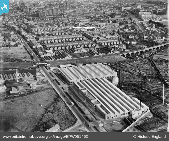
EPW051463 ENGLAND (1936). The Alvis Car and Engineering Co Works and environs, Spon End, 1936
© Copyright OpenStreetMap contributors and licensed by the OpenStreetMap Foundation. 2026. Cartography is licensed as CC BY-SA.
Nearby Images (28)
EPW051463

EPW051457

EPW051455

EPW051462

EPW051459

EPW051456

EPW051464

EPW046375

EPW046376

EPW051467

EPW044455

EPW044457

EPW044453

EPW051461

EPW051460

EPW051466

EPW044454

EPW051465

EPW051454

EPW044456

EPW046374

EPW046379

EPW044451

EPW046373

EPW046378

EPW046377

EPW044452

EPW053106

Details
| Title | [EPW051463] The Alvis Car and Engineering Co Works and environs, Spon End, 1936 |
| Reference | EPW051463 |
| Date | August-1936 |
| Link | |
| Place name | SPON END |
| Parish | |
| District | |
| Country | ENGLAND |
| Easting / Northing | 432285, 279388 |
| Longitude / Latitude | -1.5253118496746, 52.411162567649 |
| National Grid Reference | SP323794 |
Pins
Be the first to add a comment to this image!