
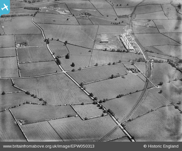
EPW050313 ENGLAND (1936). The Ridgmont Brick Works and surrounding countryside, Brogborough, 1936
© Copyright OpenStreetMap contributors and licensed by the OpenStreetMap Foundation. 2026. Cartography is licensed as CC BY-SA.
Nearby Images (2)
EPW050313

EPW050315

Details
| Title | [EPW050313] The Ridgmont Brick Works and surrounding countryside, Brogborough, 1936 |
| Reference | EPW050313 |
| Date | May-1936 |
| Link | |
| Place name | BROGBOROUGH |
| Parish | BROGBOROUGH |
| District | |
| Country | ENGLAND |
| Easting / Northing | 496145, 237525 |
| Longitude / Latitude | -0.59847789828841, 52.027372698341 |
| National Grid Reference | SP961375 |
Pins

melgibbs |
Thursday 6th of February 2014 03:51:25 PM | |
|
melgibbs |
Thursday 6th of February 2014 03:49:54 PM | |

SteveAUS |
Wednesday 8th of May 2013 06:04:35 AM |