
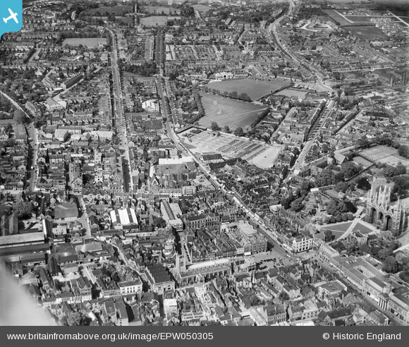
EPW050305 ENGLAND (1936). The city centre, Peterborough, 1936
© Copyright OpenStreetMap contributors and licensed by the OpenStreetMap Foundation. 2026. Cartography is licensed as CC BY-SA.
Nearby Images (6)
EPW050305

EAW046613

EPW039171

EAW046612

EAW005688

EAW046611

Details
| Title | [EPW050305] The city centre, Peterborough, 1936 |
| Reference | EPW050305 |
| Date | May-1936 |
| Link | |
| Place name | PETERBOROUGH |
| Parish | |
| District | |
| Country | ENGLAND |
| Easting / Northing | 519266, 298910 |
| Longitude / Latitude | -0.23984706282537, 52.574555259892 |
| National Grid Reference | TL193989 |
Pins


User Comment Contributions
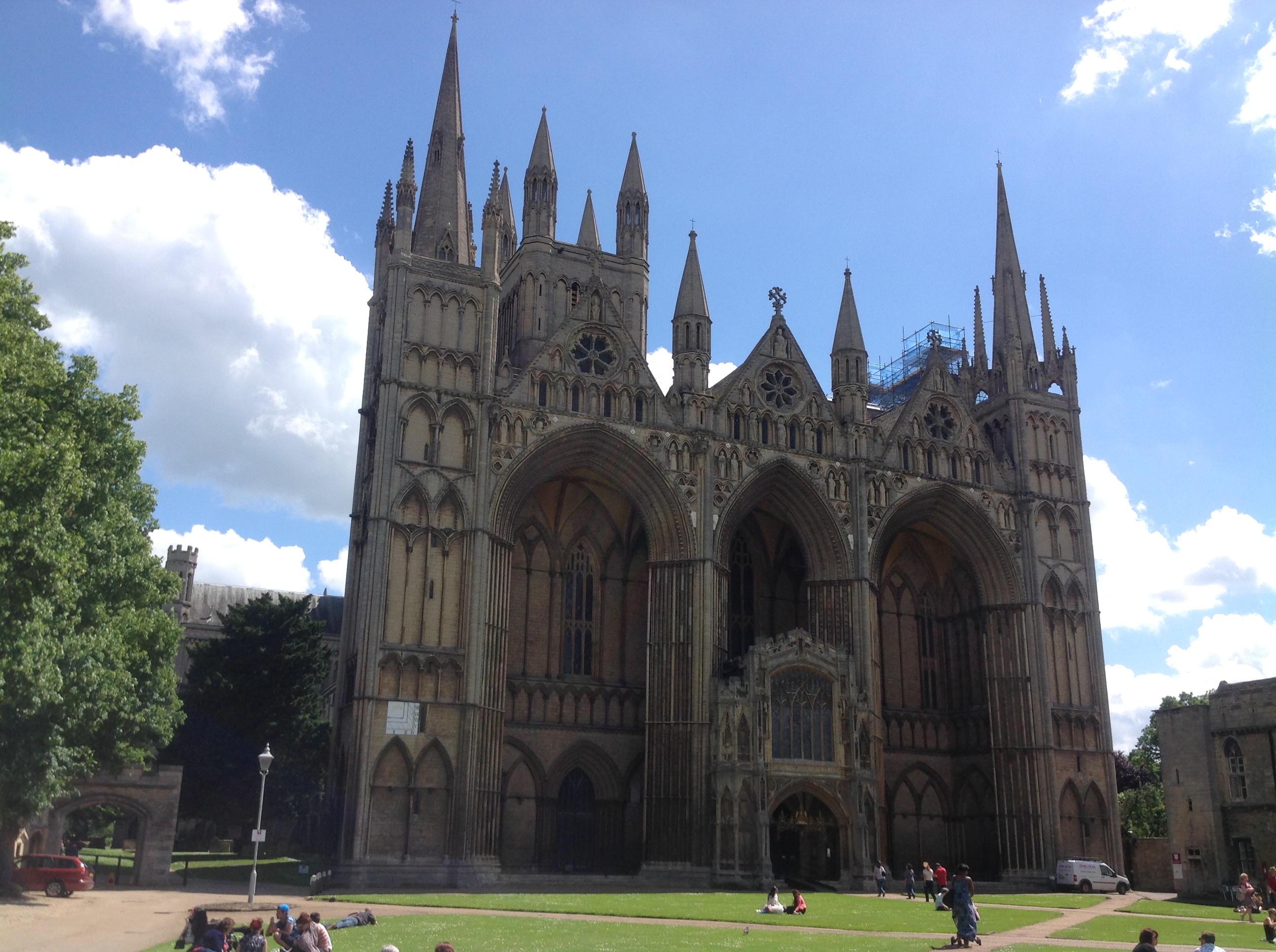
Peterborough Cathedral, properly the Cathedral Church of St Peter, St Paul and St Andrew – also known as Saint Peter's Cathedral, Peterborough , 10/06/2014 |

Class31 |
Wednesday 11th of June 2014 08:23:04 AM |