
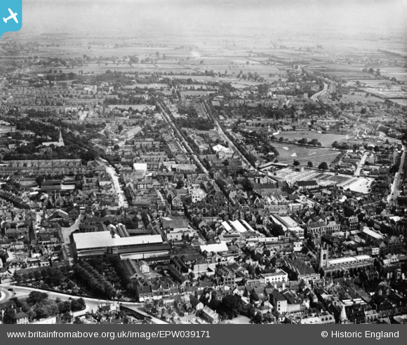
EPW039171 ENGLAND (1932). The city centre, Peterborough, from the south-west, 1932. This image has been produced from a copy-negative.
© Copyright OpenStreetMap contributors and licensed by the OpenStreetMap Foundation. 2026. Cartography is licensed as CC BY-SA.
Nearby Images (3)
EPW039171

EPW039169

EPW050305

Details
| Title | [EPW039171] The city centre, Peterborough, from the south-west, 1932. This image has been produced from a copy-negative. |
| Reference | EPW039171 |
| Date | July-1932 |
| Link | |
| Place name | PETERBOROUGH |
| Parish | |
| District | |
| Country | ENGLAND |
| Easting / Northing | 519087, 298820 |
| Longitude / Latitude | -0.24251977870212, 52.573785690384 |
| National Grid Reference | TL191988 |
Pins

Grimsby Boy |
Wednesday 24th of December 2014 05:02:48 PM | |
|
Grimsby Boy |
Wednesday 24th of December 2014 05:02:05 PM | |
|
Grimsby Boy |
Wednesday 24th of December 2014 05:01:04 PM | |
|
Grimsby Boy |
Wednesday 24th of December 2014 04:58:14 PM |