
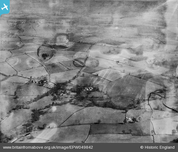
EPW049842 ENGLAND (1936). The village and surrounding countryside, Bradney, 1936
© Copyright OpenStreetMap contributors and licensed by the OpenStreetMap Foundation. 2026. Cartography is licensed as CC BY-SA.
Nearby Images (2)
EPW049842

EPW049854

Details
| Title | [EPW049842] The village and surrounding countryside, Bradney, 1936 |
| Reference | EPW049842 |
| Date | April-1936 |
| Link | |
| Place name | BRADNEY |
| Parish | WORFIELD |
| District | |
| Country | ENGLAND |
| Easting / Northing | 377093, 296111 |
| Longitude / Latitude | -2.3379564157153, 52.561989561199 |
| National Grid Reference | SO771961 |
Pins
Be the first to add a comment to this image!