
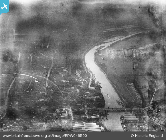
EPW049590 ENGLAND (1936). The River Thames at Kingston Bridge and environs, Kingston upon Thames, 1936. This image has been produced from a damaged negative.
© Copyright OpenStreetMap contributors and licensed by the OpenStreetMap Foundation. 2026. Cartography is licensed as CC BY-SA.
Nearby Images (6)
EPW049590

EPW022857

EPW056229

EAW003671

EPW023420

EPW005057

Details
| Title | [EPW049590] The River Thames at Kingston Bridge and environs, Kingston upon Thames, 1936. This image has been produced from a damaged negative. |
| Reference | EPW049590 |
| Date | January-1936 |
| Link | |
| Place name | KINGSTON UPON THAMES |
| Parish | |
| District | |
| Country | ENGLAND |
| Easting / Northing | 517788, 168721 |
| Longitude / Latitude | -0.30638770988844, 51.404774929919 |
| National Grid Reference | TQ178687 |
Pins
Be the first to add a comment to this image!
User Comment Contributions
Kingston Bridge |

Alan McFaden |
Monday 24th of November 2014 01:20:26 PM |
Kingston upon Thames |
Alan McFaden |
Monday 24th of November 2014 01:20:03 PM |