
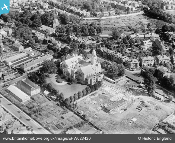
EPW023420 ENGLAND (1928). Surrey County Hall, Kingston upon Thames, 1928
© Copyright OpenStreetMap contributors and licensed by the OpenStreetMap Foundation. 2026. Cartography is licensed as CC BY-SA.
Nearby Images (5)
EPW023420

EPW022857

EPW056229

EPW049590

EPW049574

Details
| Title | [EPW023420] Surrey County Hall, Kingston upon Thames, 1928 |
| Reference | EPW023420 |
| Date | September-1928 |
| Link | |
| Place name | KINGSTON UPON THAMES |
| Parish | |
| District | |
| Country | ENGLAND |
| Easting / Northing | 518010, 168679 |
| Longitude / Latitude | -0.30321116538306, 51.404351246236 |
| National Grid Reference | TQ180687 |
Pins

UPONTHAMES |
Thursday 9th of June 2022 08:12:56 PM | |
|
UPONTHAMES |
Thursday 9th of June 2022 07:14:31 PM | |
|
John Wass |
Tuesday 8th of July 2014 08:05:05 PM | |
|
Keith |
Saturday 30th of June 2012 08:03:03 AM | |
|
Keith |
Saturday 30th of June 2012 08:02:47 AM | |
|
Keith |
Saturday 30th of June 2012 08:01:15 AM |