
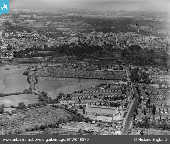
EPW048870 ENGLAND (1935). Botley Road and the city, Oxford, from the west, 1935
© Copyright OpenStreetMap contributors and licensed by the OpenStreetMap Foundation. 2026. Cartography is licensed as CC BY-SA.
Nearby Images (5)
EPW048870

EPW048873

EPW048871

EPW048872

EPW048869

Details
| Title | [EPW048870] Botley Road and the city, Oxford, from the west, 1935 |
| Reference | EPW048870 |
| Date | August-1935 |
| Link | |
| Place name | OXFORD |
| Parish | |
| District | |
| Country | ENGLAND |
| Easting / Northing | 450025, 206328 |
| Longitude / Latitude | -1.2752179157801, 51.752953706643 |
| National Grid Reference | SP500063 |
Pins

yesmaybe |
Thursday 18th of June 2020 10:49:57 AM | |
|
yesmaybe |
Thursday 18th of June 2020 10:47:05 AM |