
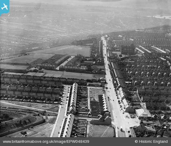
EPW048439 ENGLAND (1935). Watling Street, Jezreel's Tower and environs, Gillingham, 1935
© Copyright OpenStreetMap contributors and licensed by the OpenStreetMap Foundation. 2026. Cartography is licensed as CC BY-SA.
Nearby Images (5)
EPW048439

EPW048438

EPW048436

EPW048437

EPW013284

Details
| Title | [EPW048439] Watling Street, Jezreel's Tower and environs, Gillingham, 1935 |
| Reference | EPW048439 |
| Date | July-1935 |
| Link | |
| Place name | GILLINGHAM |
| Parish | |
| District | |
| Country | ENGLAND |
| Easting / Northing | 577900, 166839 |
| Longitude / Latitude | 0.55622009765886, 51.372200154977 |
| National Grid Reference | TQ779668 |
Pins

Kentishman |
Monday 19th of August 2024 07:36:21 AM | |
|
Trebor |
Sunday 25th of August 2013 10:07:22 AM |